The story
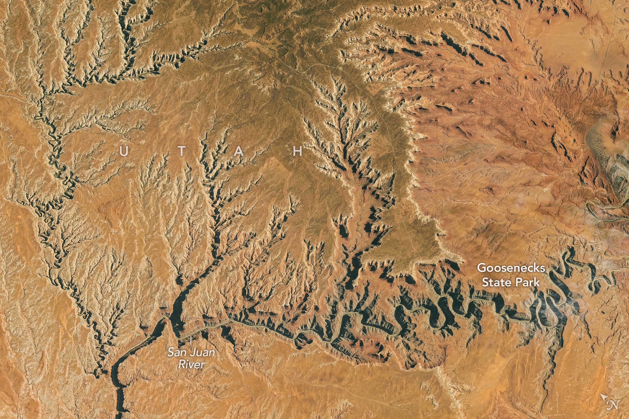
The San Juan River loops through southern Utah in bends called meanders. NASA’s new image, taken from the space station on October 6, shows those bends enclosed by steep canyon walls.
The river once crossed a flatter landscape. As the Colorado Plateau rose, the river cut downward into rock while following its existing curves. At Goosenecks State Park, the canyon is about 1,000 feet deep.
A landscape can preserve clues to its own history. The winding river and deep walls make more sense together: an older route remained as the ground around it changed.